Using Drones to Take Building Assessments to the Third Dimension
Kyle Oberdorf, P.E., recently wrote an article for our client newsletter titled "Using Drones to Take Building Assessments to the Third Dimension."
In 2017, Ryan Biggs Clark Davis purchased our first drone to supplement our facade evaluation and restoration work. The drone allowed us to access difficult-to-reach areas and elevated portions of the building in a more cost-effective and timely manner without the need for lifts or other methods. At the time, the drone was used to efficiently capture images of the structures that could be used later to evaluate existing conditions.
Since that time, the use of drones in the design and construction industry has continued to advance, as has the technology used to process the data that drones capture.
In 2021, we began exploring the use of photogrammetry to process drone data into 3D computer models.
Figure 1- RBCD’s First Project using Photogrammetry – Grace Episcopal Church, Utica NY
Photogrammetry is the science and technology of obtaining reliable information about physical objects and the environment through the process of recording, measuring, and interpreting photographic images and patterns of electromagnetic radiant imagery and other phenomena.
As it applies to the use of drones, photogrammetry is used to take information from overlapping 2D photos obtained using the drone, to generate a 3D model of the photographed object, site, or structure.
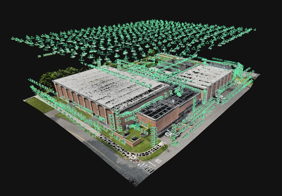
Figure 2 -Green Camera Indicates Location of All of the Images Used to Generate Model
In 2023, to increase the accuracy of the 3D models that were being generated, we updated our drone equipment to utilize Real-time Kinematic Position (RTK), allowing us to generate 3D models with survey-level accuracy. RTK utilizes a base station as an additional point of communication with the drone, providing increased accuracy.
To process the data captured by the drone, we have been utilizing Pix4D’s Pix4Dmatic software. Pix4Dmatic is a photogrammetry software that can process tens to thousands of images to generate 3D models of the captured subject. Utilizing this software, we can generate both photo-realistic models of the building, as well as 3D point cloud models, with a high degree of accuracy.
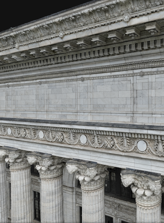
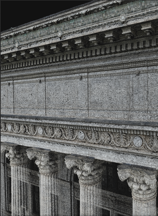
Figure 3 – Photo-Realistic Model Figure 4 – Point Cloud Model
Using the photo-realistic models of a building, we have been able to advance our evaluation of facades. We use these 3D models to supplement the information that we have gathered from our hands-on investigations, to obtain information from hard-to-reach areas or areas that are dangerous to access, and to give us a global 3D understanding of the movement of the structures. The highly detailed imagery allows us to perform detailed assessments of the building long after the lift has left the site, allowing us to better assess the whole structure for patterns of deterioration, as well as allowing us to better evaluate issues that may continue from one facade onto another. Additionally, having access to the full building model helps to reduce the need for follow up visits to review issues and can assist in identifying areas for follow up investigations or removals.
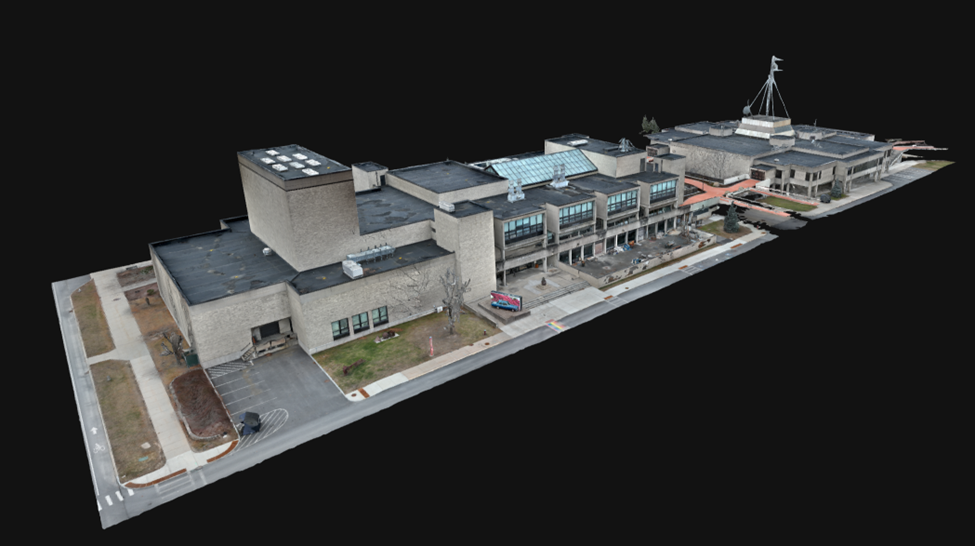
Figure 5 - Modeling of a Two Building Complex
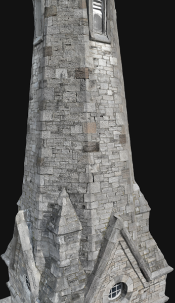
Figure 6 - Model of Church Steeple Showing a Crack on Multiple Sides of the Tower
In addition to the photo-realistic model, highly accurate 3D point cloud models allow us to evaluate existing structures for issues that may not be readily visible in photos. These issues include bulging in walls, out-of-plane movement of walls, twisting of structures, deflection of building elements, and more. The ability to take accurate measurements helps to supplement the analytical analysis of the structure and can be done in a far more cost-effective manner than conventional surveying methods.
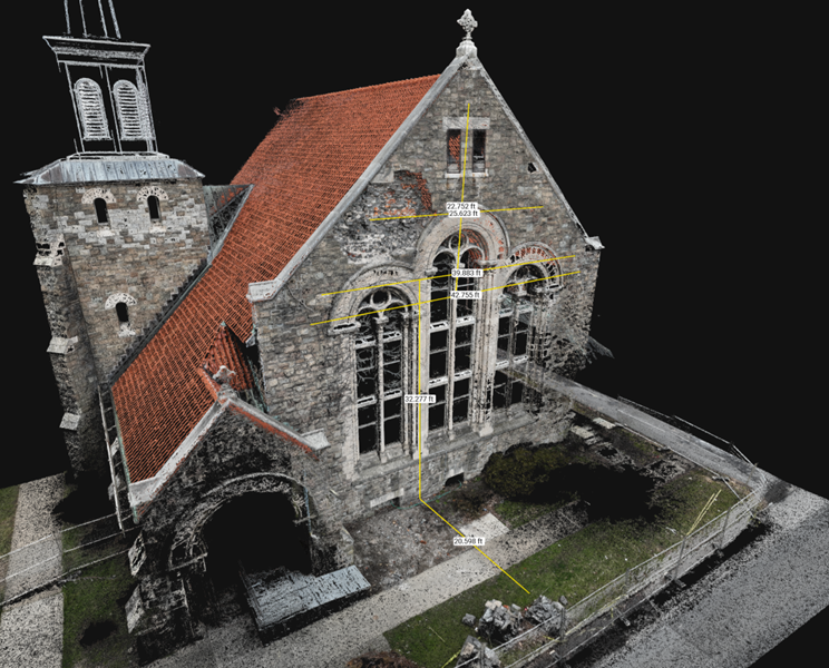
Figure 7 – Using Point Cloud Model to take Measurements of Existing Structure
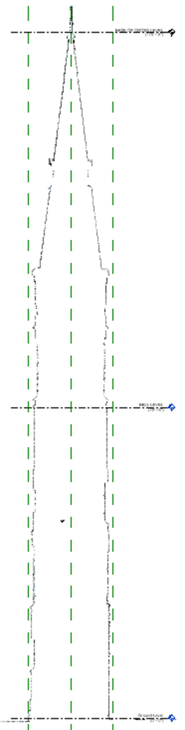
Figure 8 - Section Through Point Cloud Model to Review Tower for Plumbness
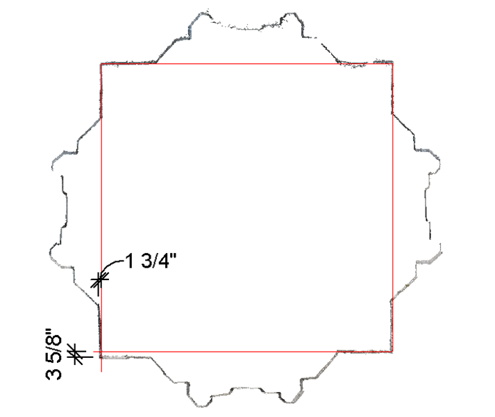
Figure 9 - Cross Section of Point Cloud Model to Review Tower for Twist
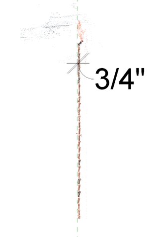
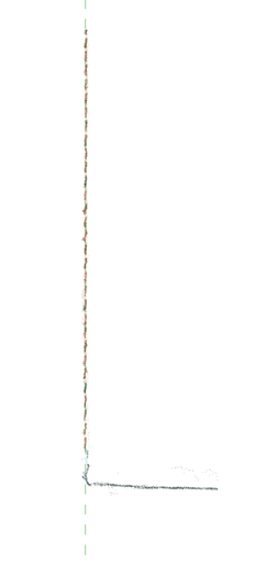
Figure 10 - Wall Section of Point Cloud Model to Review for Plumbness
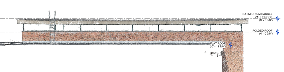
Figure 11 - Wall Evaluation Using Point Cloud Showing Deflection at Roof Edge
As our buildings and infrastructure continue to age, and more municipalities adopt code-required assessments of these structures, technology and specifically drones will continue to play a larger role in accurately and cost effectively capturing the data needed to keep buildings and infrastructure safe for decades into the future.